
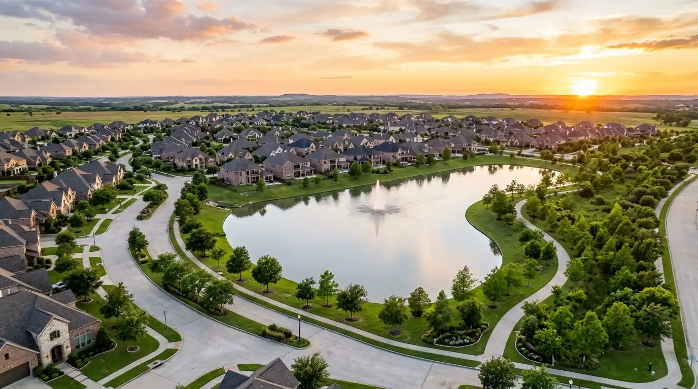
Katy is two different places that share a name. The City of Katy is a small incorporated city, incorporated in 1945 where Harris, Fort Bend and Waller counties meet, about 15 square miles with roughly 27,700 residents. The Katy area is the much larger territory of master-planned communities carrying Katy addresses, most of it outside any city, tied together by a school district that covers 181 square miles and teaches more than 97,000 students. Nearly everyone who says they live in Katy lives in the second one, and almost everything that matters about buying here, from the tax rate to the flood map to the school assignment, follows from which one you are actually in.
This guide is written by Energy Realty, whose Katy office sits at 23033 Grand Circle Boulevard and whose Houston office sits in the Energy Corridor where a large share of Katy residents commute each day. It covers the city versus the area, the master-planned communities and the utility districts behind them, Katy ISD as a boundary structure, new construction against resale, the commute, the tax arithmetic, the flood record, daily life and the things a listing will not tell you. Every number carries its source and its date.
The City of Katy versus the Katy area
Start with the Census. The City of Katy had an estimated 27,741 residents on July 1, 2024, up from 21,859 at the 2020 count, on 15.294 square miles of land. That is the incorporated city: the historic downtown around the railroad, the older neighborhoods, the city hall, and a city property tax. It straddles three counties, which is unusual and occasionally confusing on a tax bill.
Now look at the counties around it. Fort Bend County grew from 822,989 to an estimated 958,434 between 2020 and 2024. Harris County passed five million. Waller County, to the northwest, grew from 56,750 to 65,109. And the City of Fulshear, immediately west of Katy, went from 16,699 to 54,629 in the same four years, which is the single clearest indicator of where the growth corridor now points. Most of that growth landed in master-planned communities that use a Katy mailing address (ZIP codes 77449, 77450, 77493 and 77494) without being inside the City of Katy or, in Fulshear’s case, without being in Katy at all.
The practical consequences of living in the area rather than the city:
- You pay no city tax, but you pay a municipal utility district instead, and the district’s rate varies enormously with its age.
- Your services come from the county, the MUD and your property owners association, not a city council.
- Your county may be Harris or Fort Bend, with different appraisal districts, tax offices and county rates.
- Your school district is almost always Katy ISD, but the western edge of the area is Lamar CISD and the northern edge can be Cy-Fair ISD.
Sources: U.S. Census Bureau, Vintage 2024 population estimates for cities and counties in Texas and the 2024 Gazetteer; Texas State Historical Association, Handbook of Texas, “Katy, TX.” Retrieved August 24, 2026.
A short history, because it explains the map
The town was first known as Cane Island, after the creek that still runs through it and still floods it. The Missouri, Kansas and Texas Railroad, the MKT or “Katy,” built through by the end of 1893, and the name either came from the railroad or from a saloonkeeper’s wife, depending on which story the Handbook of Texas prefers. Rice farming arrived in 1901, the Katy gas field’s discovery well was drilled in 1934, and the city incorporated in 1945. The old rice-and-gas town is the City of Katy; the rice fields around it are the master-planned communities. When you see a subdivision named for a ranch, a creek or a lake, you are looking at the second half of that history.
Source: Texas State Historical Association, Handbook of Texas, “Katy, TX.” Retrieved August 24, 2026.
The master-planned communities, and what is verified about each
The Katy area is one of the country’s most active corridors for large-scale planned communities, and a buyer’s first job is to understand that each one is a small municipality in all but name: a developer, one or more property owners associations, and one or more utility districts. Here is what the developers and associations themselves publish.
Cinco Ranch
The anchor of the Katy area. The Cinco Residential Property Association describes Cinco Ranch as a master-planned community spanning more than 5,000 acres developed by Newland Communities, with the first residents moving in during 1991 and control of the association passing to homeowners in 2005. It contains 8,740 residential lots under that association, and a later section informally known as Cinco II is governed by a separate association. The community is served by Cinco MUDs 1 through 14, Fort Bend County MUD 35 and Cornerstones MUD, each with its own elected five-member board. LaCenterra at Cinco Ranch, the area’s outdoor lifestyle center, is at 23501 Cinco Ranch Boulevard. Energy Realty publishes a Cinco Ranch guide with current listings.
Elyson
North of I-10 in 77493, off FM 529 west of the Grand Parkway. Brookfield Residential is the master developer, and the community’s own site lists nine builders and 27 model homes. It is served by Katy ISD, with Cy-Fair ISD for the neighborhoods east of Peek Road, which is the clearest published example of one community straddling two districts.
Cane Island
Also north of I-10 in 77493, three minutes from the freeway on Cane Island Parkway, just west of the Grand Parkway, at 2100 Cane Island Parkway. Named for the creek and the original settlement.
Cross Creek Ranch and Jordan Ranch (Fulshear, not Katy)
Both are Johnson Development communities in Fulshear, west of Katy. Cross Creek Ranch covers 3,200 acres. Jordan Ranch is planned for 3,000 homes with 450,000 square feet of commercial space, sits one mile from I-10, and is in Lamar CISD with an on-site elementary school. They are routinely listed as Katy communities by portals and by other agents. They are not, and the difference shows up in the county, the school district and the address.
Seven Meadows, Grand Lakes, Kelliwood, Falcon Landing, Firethorne
Established communities south and west of I-10 where Energy Realty transacts regularly. We have not published acreage or home counts for them because no developer or association page we could verify states them, and we would rather leave a number out than repeat a portal’s guess. Kelliwood-area streets were among the test properties in the federal litigation over the Barker Reservoir flood pool, which is covered below.
Sources: Cinco Residential Property Association (cincoranch.life); elyson.com; caneisland.com; Johnson Development, Cross Creek Ranch and Jordan Ranch pages; Katy Area Economic Development Council. Retrieved August 24, 2026.
Katy ISD as a boundary structure
Katy ISD is the reason the Katy area exists as one market. The district describes itself as encompassing 181 square miles, headquartered at 6301 South Stadium Lane. For 2025-26 it reported more than 97,000 students with 14,000 educators and staff, and its board’s September 22, 2025 action noted the district had expanded to 80 campuses. The district’s site lists 44 elementary schools, 18 junior highs and ten comprehensive high schools (Cinco Ranch, Freeman, Jordan, Katy, Mayde Creek, Morton Ranch, Paetow, Seven Lakes, Taylor and Tompkins) plus a virtual high school. Its demographer projects roughly 2,000 new students a year, which is why attendance boundaries are modified on a regular cycle.
Two facts follow that a buyer should hold onto. First, the campus assigned to a house is a boundary fact, not a subdivision fact; boundaries are drawn by the district and change, and a community’s marketing does not decide them. Second, the Katy area’s western edge is Lamar CISD, which serves Fulshear and describes itself as one of the fastest-growing districts in Texas with seven high schools, and its northern edge can be Cy-Fair ISD. We do not rank schools or compare them, and we will not tell you a neighborhood is “zoned to the best schools.” The district’s boundary page is the source, and we will help you read it for any specific address before you make an offer.
The district’s 2025 tax rate, held by the board on September 22, 2025, is $0.7271 for maintenance and operations plus $0.3900 for debt service, a total of $1.1171 per $100 of value. It is the largest single line on any Katy tax bill.
Sources: Katy ISD, About Katy ISD; Katy ISD news, August 2025 and September 22, 2025; Katy ISD attendance boundary modification pages; Lamar CISD district profile; Harris Central Appraisal District jurisdiction list, 2025. Retrieved August 24, 2026.
New construction versus resale
Katy is one of the places in the country where a buyer genuinely has the choice, and the two paths are different transactions.
New construction comes with a builder’s price sheet, a menu of incentives that often move with interest rates, lot premiums, a construction timeline and a warranty. It also comes with a utility district that may still be paying off its construction bonds, which can mean a much higher tax rate than a mature district, and with a flood map that may have been redrawn since the subdivision was platted. The sales representative in the model home works for the builder, not for you, which means that if you walk in without your own agent, no one in the transaction represents your side on price, incentives, the utility district notice, the flood disclosure, the inspection schedule or the warranty terms. Bring your own agent to the first visit, and ask the builder for its agent-registration policy in writing; a builder may decline to recognize representation added afterward. That advice is worth more in Katy than almost anywhere in Houston.
Resale in Cinco Ranch, Grand Lakes, Seven Meadows or the City of Katy comes with a mature utility district and a lower rate, established trees, a known flood history that the seller must disclose, and a foundation that has already done whatever the clay was going to make it do. It also competes with the builders. Our August 2026 market update noted that in some areas of Katy homes were taking longer to sell than in recent years, and a resale seller here is pricing against a builder’s incentive package a mile away. That cuts both ways: a resale buyer has negotiating room, and a resale seller needs a realistic price, good preparation and patience.
Sources: Energy Realty, August 2026 Market Update. Retrieved August 24, 2026.
The commute
Interstate 10 is the spine, and the arithmetic is simple because I-10’s exit numbers are mile-based. The Katy Fort Bend Road exit is 742, the Eldridge Parkway exit in the Energy Corridor is 753 and the I-45 downtown exit is 768, which makes Katy roughly 11 freeway miles from the Energy Corridor and roughly 26 from downtown. I-10 is one of the region’s most congested corridors, so time is a different question from distance and depends on the hour.
State Highway 99, the Grand Parkway, is the north-south bypass. Segment D, the 17.4-mile stretch from US 59 in Sugar Land north to I-10 near Katy, has been open since August 31, 1994 and is operated in two pieces: the Fort Bend County Toll Road Authority from US 59 to south of Fry Road, and TxDOT from there to I-10. TxDOT’s rate at the Colonial Parkway plaza, effective January 1, 2026, is 56 cents for a two-axle vehicle with a TxTag and 84 cents by mail; drivers without a tag pay 50 percent more on SH 99. The Fort Bend County Toll Road Authority adjusted its Westpark Tollway, Fort Bend Parkway and Grand Parkway rates by 2 percent on January 1, 2026 under its annual policy. METRO runs park and ride lots at 1030 North Grand Parkway and 21669 Kingsland Boulevard in Katy, feeding the same I-10 corridor to downtown.
Sources: TxDOT, SH 99 Segment D page and SH 99 toll rates effective January 1, 2026; Fort Bend County Toll Road Authority, annual toll rate adjustment January 1, 2026; METRO transit facility addresses. Distances derived from TxDOT mile-based exit numbering. Retrieved August 24, 2026.
Property taxes and the utility district behind every subdivision
Texas has no income tax, and Katy’s property tax bill is where that shows up. A bill is the sum of the taxing units an address falls in, each with a rate per $100 of appraised value. The key variable in Katy is the municipal utility district, a local government created under Chapter 54 of the Texas Water Code that borrowed to build a subdivision’s water, sewer and drainage system and repays the bonds with its own property tax. New districts carry high rates; mature districts carry low ones. Texas Water Code Section 49.452 requires the seller to give you a written notice of the district’s current tax rate and bonded debt before you sign a binding contract, and Section 49.4521 prescribes its wording.
| Line | Unincorporated Fort Bend, Katy ISD, mature Cinco district | Inside the City of Katy (Fort Bend County side) | Unincorporated Harris, Katy ISD |
|---|---|---|---|
| County | 0.412 (Fort Bend) + 0.010 drainage | 0.412 (Fort Bend) + 0.010 drainage | 0.38096 (Harris) |
| Flood control, port, hospital | n/a in Fort Bend | n/a in Fort Bend | 0.04966 + 0.00590 + 0.18761 |
| Katy ISD | 1.1171 | 1.1171 | 1.1171 |
| City | none | 0.425 (City of Katy) | none |
| Utility district | 0.2942 (Cinco MUD 9) + 0.145 (Willow Fork Drainage District) | none | 0.2499 (Nottingham Country MUD) |
| Approximate total | about 1.98 | about 1.96 | about 2.00 before any emergency services district |
The City of Katy straddles three counties, so the middle column models its Fort Bend side; on the Harris County side the same configuration totals about 2.17, because the Harris County lines replace the Fort Bend ones. Those three examples land close together because they use mature districts. Swap in a young district still carrying its construction debt, and the total climbs: Fort Bend County MUD 162 levied 1.10 per $100 in 2025, Harris County MUD 542 levied 1.07, 38 Harris County districts levied $1.00 or more, and the highest rate on the Harris County list was 1.72, in a district outside the Katy area. That spread is the single most important number a Katy buyer can understand, and the district notice the seller hands you is where you find it. The Texas Commission on Environmental Quality’s district database listed 460 active municipal utility districts in Harris County and 207 in Fort Bend County as of August 24, 2026, which gives a sense of how granular this is.
Relief for a primary residence: the school district homestead exemption rose to $140,000 with the constitutional amendment approved November 4, 2025, with an additional $60,000 for owners 65 and older or disabled; a homestead’s taxable value cannot rise more than 10 percent a year; and every owner can protest the appraisal each spring. Our full MUD and property tax guide works through the arithmetic with more districts.
Sources: Harris County Tax Assessor-Collector, 2025 tax rates; Harris Central Appraisal District jurisdiction list; Fort Bend Central Appraisal District, 2025 tax rates; Katy ISD board action, September 22, 2025; Texas Water Code Sections 49.452 and 49.4521; Texas Comptroller, property tax exemptions. Totals are simple sums of the listed 2025 rates and exclude community college and emergency services districts. Retrieved August 24, 2026.
Flood: the record, and how to read it for one house
Katy’s history begins with a creek called Cane Island Branch, and its flood history runs through the same creek. The Harris County Flood Control District’s final report on Hurricane Harvey records “record flooding along upper Buffalo Bayou and Cane Island Branch from southeast Waller County through the City of Katy to Barker Reservoir” in August 2017, and it records that the record pool in Barker Reservoir “resulted in water levels overtopping the banks of the bayou near Fry Road and east of SH 99.” The district counted 630 homes flooded in the Harris County portion of the City of Katy, and it noted that about 15,000 additional homes flooded outside Harris County, including in Fort Bend County in the flood pool of Barker Reservoir.
That last phrase is the one to understand. The Barker and Addicks reservoirs are federally owned dry dams operated by the Army Corps of Engineers, and their maximum flood pools extend beyond the government-owned land onto private subdivisions. During Harvey they filled to record levels and did exactly that. The federal trial that followed used test properties in the Barker flood pool in Katy, including streets in the Kelliwood area, and in the Addicks flood pool in Houston, including the Lakes on Eldridge subdivision. Parts of Katy and west Houston upstream of the dams lie within the reservoirs’ maximum pools, and whether a given parcel does is a question for the Corps’ and the county’s maps, the recorded plat and the seller’s disclosure. The Court of Federal Claims found in December 2019 that the government had taken a flowage easement over the upstream properties, and the Federal Circuit affirmed liability in December 2025 while sending some damages questions back.
Texas law changed in response. Since September 1, 2019, the seller’s disclosure notice must state whether the property lies wholly or partly in a 100-year floodplain, a 500-year floodplain, a floodway, a flood pool or a reservoir, and whether it has flooded because of a reservoir release. A landlord must give a tenant a written flood notice before a lease is signed. And Harris County now requires new construction and substantial improvements in the mapped floodplain of unincorporated areas to have the lowest habitable floor at least 24 inches above the 500-year flood elevation, or 12 inches above the crown of the nearest public street, whichever is higher.
Look it up on FEMA’s Flood Map Service Center and the Harris County or Fort Bend County flood mapping tools. Read the seller’s disclosure answers on flooding, flood insurance, reservoir releases and the flood pool. Ask for a flood insurance quote before you write the offer, whether or not the lender will require a policy. And do not accept “Katy doesn’t flood” from anyone. Neither the map nor the record supports it for any subdivision as a whole, and the honest answer is per parcel. Our flood zone guide walks through each step.
Sources: Harris County Flood Control District, Immediate Flood Report, Hurricane Harvey 2017 (final); U.S. Court of Federal Claims, In re Upstream Addicks and Barker (Texas) Flood-Control Reservoirs, December 17, 2019; U.S. Court of Appeals for the Federal Circuit, Ablan v. United States, December 22, 2025; Texas Property Code Sections 5.008 and 92.0135; TREC Seller’s Disclosure Notice, Form 55-1; Harris County floodplain management regulations effective January 1, 2018, amended July 9, 2019. Retrieved August 24, 2026.
Daily life in Katy
The Katy area’s retail and recreation cluster along I-10 and the Grand Parkway. LaCenterra at Cinco Ranch, at 23501 Cinco Ranch Boulevard, is the outdoor lifestyle center with the Central Green that hosts community events. Katy Mills, at I-10 and Pin Oak Road, is the outlet mall, and Typhoon Texas, the water park beside it, opened on May 28, 2016. Katy Asian Town, at 23119 Colonial Parkway on the northeast corner of I-10 and the Grand Parkway, is a 100,000-plus-square-foot center of Asian restaurants and grocers. The Katy Boardwalk District is an approximately 80-acre mixed-use development off Kingsland Boulevard just south of I-10, built around a 90-acre lake and nature preserve, with a conference center hotel, loft residences and retail, within walking distance of Typhoon Texas and Katy Mills. The historic downtown grew up around the MKT railroad that reached it by the end of 1893.
George Bush Park, 7,800 acres inside the Barker Reservoir with 11.36 miles of hike and bike trails, is the area’s largest park and sits between Katy and the Energy Corridor. Employment inside the area has grown with the population: Amazon’s HOU5 sort center at 22525 Clay Road, an 800,000-square-foot facility that opened in October 2020 with up to 3,000 jobs, is the largest recent example. The British International School of Houston is at 2203 North Westgreen Boulevard in Katy.
Sources: Katy Area Economic Development Council; typhoontexas.com; katyasiantown.com; katyboardwalkdistrict.com; Harris County Precinct 4; Texas Department of Licensing and Regulation project record and Houston Chronicle on Amazon HOU5; nordangliaeducation.com. Retrieved August 24, 2026.
What no one tells you about Katy
- Your address is not your jurisdiction. “Katy, TX 77494” can mean unincorporated Fort Bend County in a Cinco district, unincorporated Harris County in a different district, or Fulshear. The county, the appraisal district, the tax stack and the flood map all change with the line, and the mailing address does not tell you which side you are on.
- The MUD is the tax rate. Two houses of the same size and age, a few miles apart, can differ by a full percentage point of value every year for the life of the district’s bonds. Read the notice.
- Flood is per parcel, and the reservoir is the reason. The Barker flood pool reaches into subdivisions that look nothing like a floodplain on a dry day. The seller’s disclosure asks the question directly; make sure it is answered.
- The builder’s rep is not your agent. Bring your own to the first visit.
- The commute defines the suburb, not the reverse. Katy works because of I-10 and the Grand Parkway. It works best for households with a job in the Energy Corridor, the west side or a park and ride, and worst for a downtown or Medical Center commute at peak hours.
- The school boundary is the district’s, not the community’s. Verify the assigned campus for the address, and expect it to be revisited as the district grows by 2,000 students a year.
Frequently Asked Questions
Is Katy a city or a suburb of Houston?
Both, and the difference matters. The City of Katy is a separate incorporated city, incorporated in 1945 at the point where Harris, Fort Bend and Waller counties meet, covering about 15.3 square miles with an estimated 27,741 residents in 2024. The Katy area is far larger: the master-planned communities carrying Katy addresses in ZIP codes 77449, 77450, 77493 and 77494 sit mostly in unincorporated Harris and Fort Bend County, outside any city, and are tied together by Katy ISD, which covers 181 square miles. Most homes with a Katy address are not in the City of Katy.
How far is Katy from Houston and the Energy Corridor?
Interstate 10 exit numbers are mile-based: the Katy Fort Bend Road exit is 742, the Eldridge Parkway exit in the Energy Corridor is 753 and the I-45 downtown exit is 768, so Katy is roughly 11 freeway miles from the Energy Corridor and roughly 26 from downtown. Drive times depend on the hour; I-10 is one of the region’s most congested corridors.
What are the main master-planned communities in Katy?
Cinco Ranch is the anchor of the Katy area, a Newland community of more than 5,000 acres whose first residents arrived in 1991, with 8,740 residential lots under the Cinco Residential Property Association and a later section under a separate association. Elyson (Brookfield Residential) and Cane Island are north of I-10 in 77493. Seven Meadows, Grand Lakes, Kelliwood, Falcon Landing and Firethorne are south and west. Cross Creek Ranch (3,200 acres) and Jordan Ranch (planned for 3,000 homes) are in Fulshear, west of Katy, not in Katy.
How big is Katy ISD?
Katy ISD covers 181 square miles from its headquarters at 6301 South Stadium Lane and reported more than 97,000 students for 2025-26 across 80 campuses, including 44 elementary schools, 18 junior highs, ten comprehensive high schools and a virtual high school. Its demographer projects roughly 2,000 new students a year, which is why attendance boundaries are modified regularly. Its board held the total tax rate at $1.1171 per $100 of value for 2025. The assigned campus for any address should be verified with the district.
What is a MUD and why do Katy tax rates vary so much?
A municipal utility district is a local government created under the Texas Water Code that borrows to build a subdivision’s water, sewer and drainage system and repays the bonds with its own property tax. Cinco Ranch alone is served by Cinco MUDs 1 through 14, Fort Bend County MUD 35 and Cornerstones MUD. A mature district that has paid down its bonds can levy around 0.23 to 0.30 per $100 of value, while a young district still carrying its construction debt can levy 1.00 or more (the highest Harris County MUD rate in 2025 was 1.72), which is why two similar homes a few miles apart can differ by a full percentage point in total tax rate. A seller must give you the district’s rate and bonded debt in writing before you sign a contract.
Do I need my own agent to buy new construction in Katy?
The sales representative in the model home works for the builder, not for you. Nothing stops you from buying without your own agent, but you will have no one representing your side on the price, the incentives, the lot premium, the utility district’s rate, the flood zone, the inspection schedule or the warranty terms. Bring your own agent to the first visit, and ask the builder for its agent-registration policy in writing; a builder may decline to recognize representation added later.
Does Katy flood?
Parts of it did during Hurricane Harvey in August 2017, and no honest guide can promise otherwise for any street. The Harris County Flood Control District’s final report records record flooding along upper Buffalo Bayou and Cane Island Branch through the City of Katy to Barker Reservoir, with the record Barker pool overtopping the bayou’s banks near Fry Road and east of State Highway 99. It counts 630 homes flooded in the Harris County portion of the City of Katy and about 15,000 more outside Harris County, including in the Barker Reservoir flood pool in Fort Bend County. The 2019 federal trial’s test properties included Kelliwood-area streets in the Barker flood pool, and parts of Katy upstream of Barker Reservoir lie within its maximum flood pool. Check the FEMA zone, the reservoir flood pool question on the seller’s disclosure and a flood insurance quote for every specific address.
What is the property tax rate in Katy?
There is no single rate; it depends on which taxing units an address falls in. Katy ISD’s 2025 rate is 1.1171 per $100. Inside the City of Katy the city adds 0.425 and there is no utility district. Outside the city, a municipal utility district replaces the city line, and the county stack differs between Harris County (0.38096 county, 0.04966 flood control, 0.00590 port, 0.18761 hospital district) and Fort Bend County (0.412 county plus 0.010 drainage). Worked examples land near 1.96 to 2.00 per $100 for a mature Cinco Ranch district or the Fort Bend side of the City of Katy, about 2.17 on the Harris side of the city, and about 2.8 or more in a young district still paying off its bonds. The school homestead exemption is $140,000 as of the November 2025 amendment.
What is the difference between Katy and Cinco Ranch?
Cinco Ranch is a master-planned community with a Katy mailing address, not a city. It spans unincorporated Harris and Fort Bend County land south of I-10, is governed by property owners associations rather than a city council, and is served by its own utility districts. The City of Katy is the incorporated city around the historic downtown at the county junction north of I-10. A Cinco Ranch homeowner pays the county on that parcel’s side of the line, Katy ISD and MUD taxes; a City of Katy homeowner pays city taxes and no MUD.
What is there to do in Katy?
LaCenterra at Cinco Ranch at 23501 Cinco Ranch Boulevard is the area’s outdoor lifestyle center. Katy Mills is the outlet mall at I-10 and Pin Oak Road, and Typhoon Texas, the water park beside it, opened in May 2016. Katy Asian Town at 23119 Colonial Parkway, at the northeast corner of I-10 and the Grand Parkway, is a 100,000-plus-square-foot Asian retail and dining center. The Katy Boardwalk District is an 80-acre mixed-use development around a 90-acre lake off Kingsland Boulevard. George Bush Park’s 7,800 acres and 11.36 miles of trails are just east, and the historic downtown grew up around the MKT railroad that reached it by the end of 1893.
Is now a good time to sell a home in Katy?
It is a market that rewards accurate pricing and preparation. In its August 2026 market update, Energy Realty noted that in some areas of Katy homes were taking longer to sell than in recent years, that higher inventory was giving buyers more negotiating power, and that every home can sell at the right price even if that price is not what the seller expected in January. Resale sellers in Katy compete directly with new construction and its incentives, which makes staging, condition and a realistic list price matter more than usual.
Who is a good real estate brokerage for Katy?
Look for a brokerage with an office in Katy, agents who can explain a utility district notice and a flood disclosure without looking them up, and the ability to represent you against a builder. Energy Realty’s Katy office is at 23033 Grand Circle Boulevard, Suite 150-B, reached at (346) 307-7464, with a second office in the Energy Corridor where many Katy residents work, a relocation program led by a Relocation Director with four relocation designations, and agents whose bios show Spanish, Portuguese, French, Farsi and Arabic alongside English.
Keep reading
- MUD districts and Houston property taxes explained: why one Katy subdivision pays more than the next
- Buying a home in a Houston flood zone: flood maps, the Addicks and Barker reservoirs, insurance and disclosure
- Living in the Energy Corridor, Houston: the complete guide
- Relocating to Houston for an energy job: the corporate and international relocation guide
- Memorial, Houston real estate guide
- Sherry Campbell, founder and broker of Energy Realty
- Katy homes for sale and the monthly market report
Buying, selling or building in Katy?
Our Katy office is at 23033 Grand Circle Boulevard. Bring us the address, the community or the builder you are considering, and we will start with the utility district, the flood map and the school boundary before we talk about the kitchen.
Social Cookies
Social Cookies are used to enable you to share pages and content you find interesting throughout the website through third-party social networking or other websites (including, potentially for advertising purposes related to social networking).